What Can I Do with a Geography Degree?
According to the U.S. Department of Labor Occupational Outlook Handbook, 2007-2008 Edition, Geography is expected to grow from 2006 to 2016. Growth is predicted to significantly increase for surveyors, cartographers, photogrammetrists, and surveying and mapping (Geographical Information Systems) technicians (increase by 21 percent from 2006 to 2016). Growth is also predicted for teachers at the secondary level, and professors at colleges and universities.
Association of American Geographers (AAG)
- Preparing for a Geography career
- Geography Career Profiles
- Geography Careers (STEM)
Geographers can find jobs in a diverse array of fields.
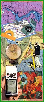
Geospatial Technology - Get the GIST!
- Geospatial Technology
- GIST Certificate program: Get the GIST Certificate
- Geograhical Information Systems (GIS)
- Remote Sensing: satellites & drones
- GPS
- Learn more by watching Penn State's Geospatial Revolution Video Trailer (5 minutes)

- cartography (map making)
- computer mapping
- topographical site surveys
- land surveys (requires further education)
- natural resource data acquisition
- land data statistical analysis
- soil field work and analysis
- biophysical field work and analysis
- socio-economic and political surveys and analysis
Physical and/or Human Geography
- environmental assessment, monitoring, mitigation, reclamation, protection, and management
- land use studies
- resource potential analysis
- ecological surveys and analysis
- site and route selection
- sustainable development studies
Physical Geography
- soil evaluations, surveys, and erosion evaluation
- irrigation and crop planning and monitoring
- biophysical surveys and analyses
- meteorology, hydrology, and watershed management
- pollution monitoring
Human and Regional Geography
- urban, rural, regional and land use planning
- socio-economic studies
- development studies
- market research
- transportation planning and data collection
- historical-geographical heritage studies
- park surveys, recreation and tourism studies
For more on the geospatial technology, our courses, and outreach to K-12 schools please contact Jon Little.
“The GIS program at Monroe Community College has helped me make connections in the local GIS community, provided me with the skills and guidance to be able to work as a professional in this field, and I secured an internship with the help of the connections that I made as a student in the program.
I was able to use what I learned in class in a practical and professional setting as well as lay the ground work for a new career using GIS. I am grateful for my experience and that MCC offers this certificate program. I look forward to taking more classes and completing the certificate in the near future!”
Anne Tatarsky, 2013 GIS student
Contact Information
Jessica Barone
Department Chair
Brighton Campus
Building 8, Room 214
Mon thru Fri, 8:45am to 4:45pm
(585) 292-2448
jbarone@monroecc.edu
Department Secretary
Brighton Campus
Building 8, Room 210
Mon thru Fri, 8:45am to 4:45pm
(585) 292-2425